Just submitted a bunch of feedback to Apple about Tahoe and it feels so good.
-
-
M5?!

-
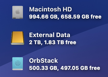
The generic external drive icon in macOS 26.1 beta 1 still hasn’t been updated. Beta 2, maybe? Either way, inexplicable and worrying lack of attention to detail from Apple.
-
Tahoe 26.1 is already showing quite a performance improvement over 26.0 on my M1 Pro MBP. Hoping this sustains throughout the beta cycle.
-
QGIS Mac users, take note: The LTR version, at least, will not install on Tahoe right now from MacPorts due to problems with qt5-qtlocation and py313-fiona. (Hopefully I don’t find more problems once these are fixed!)
-
Fully upgraded to the 26 release versions, save for my work computer which is getting 18.7 while MacPorts and the like get sorted out.
-
The iOS betas tend to refocus my release day excitement toward third party apps adopting the year’s new SDK. Especially interesting this year with the UI changes and how apps will blend their design language with Liquid Glass.
-
The sometimes-left-justified title bars in macOS 26 are breaking my brain. I usually get used to things fairly quickly, but they just look wrong and non-Mac-like.
-
I rotate through monospaced typefaces on occasion, and I’m back into Monaco. I just love this font, and wish Apple would upgrade it with true bold, italic, and maybe even some Powerline glyphs.
-
I give it two weeks before I upgrade everything to the 26 series of Apple releases now that we are likely moving into weekly betas soon.
-
TIL installing QGIS from MacPorts builds it from source locally, giving you a native Apple Silicon build that is so, so, so much faster.
-
Windows would decide to no longer display any mouse pointer, even after a restart, with a tropical system nearby.
-
Note to future me:
The morning walks are great. Keep going.
-
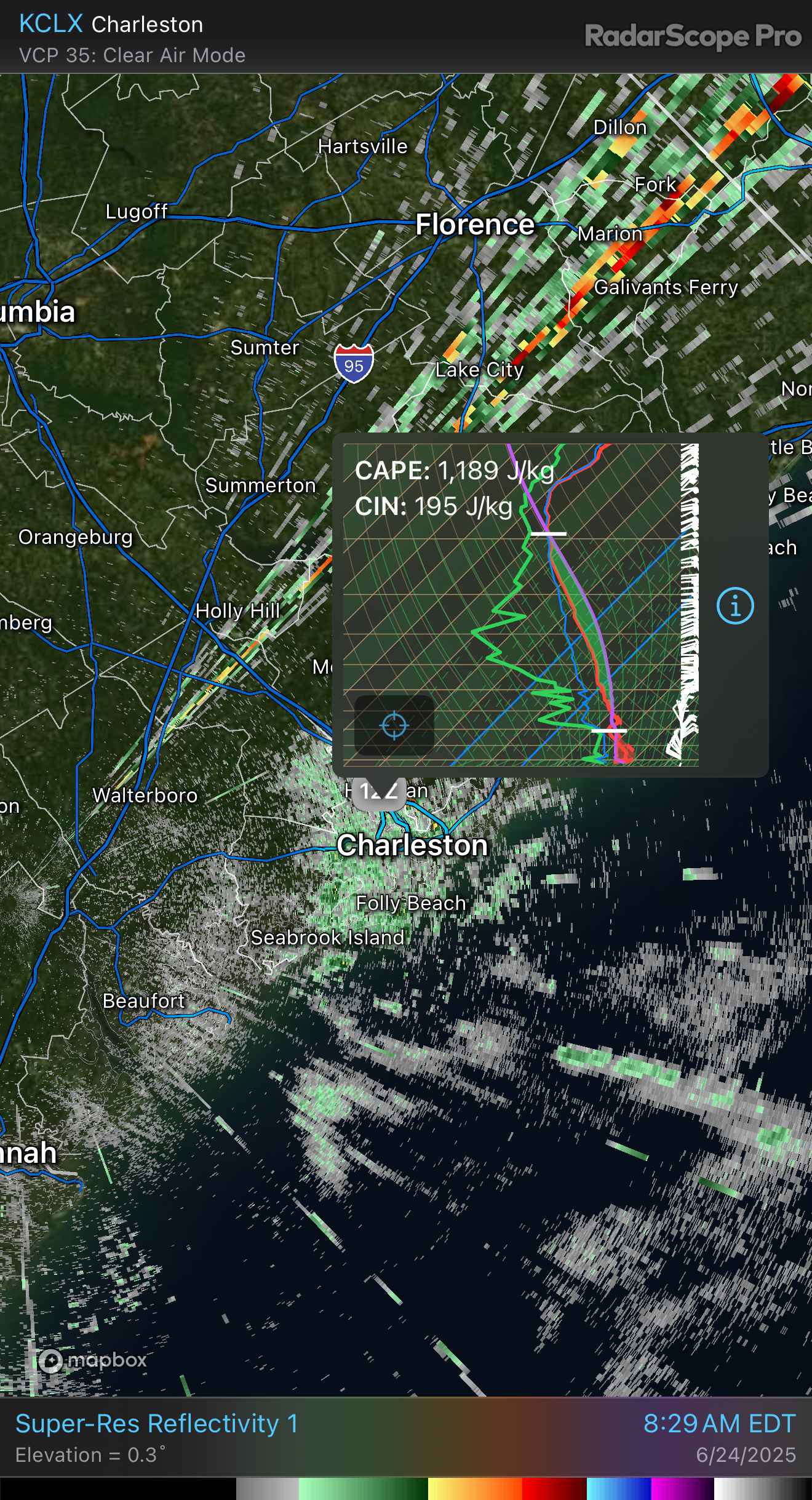
Just a tad bit of an inversion this morning.
-
Pleasantly surprised to find that iMessage junk filtering is available in iOS 18.6 beta. Hope it doesn’t get axed during this cycle – genuinely great to get this now ahead of iOS 26 this summer.
-
Am I the only person who still sends primarily plaintext emails?
-
Kind of unreal that iPadOS 26, with its focus on upgraded multitasking, still doesn’t have a way to create a shortcut that runs when connecting a Smart Keyboard. I just want to switch multitasking modes when a keyboard is connected vs. when it isn’t. Too much to ask?
-
One tough part of having a side project that is actually operational and relied-upon is that I can’t always just try new things on a whim. Like, I need things to work and work reliably. Might need a side project from the side project.
-
but i don’t wanna do another week of this
— Marisa Kabas ([@marisakabas.bsky.social](http://marisakabas.bsky.social)) April 6, 2025 at 11:09 PMOh do I feel this so much.
-
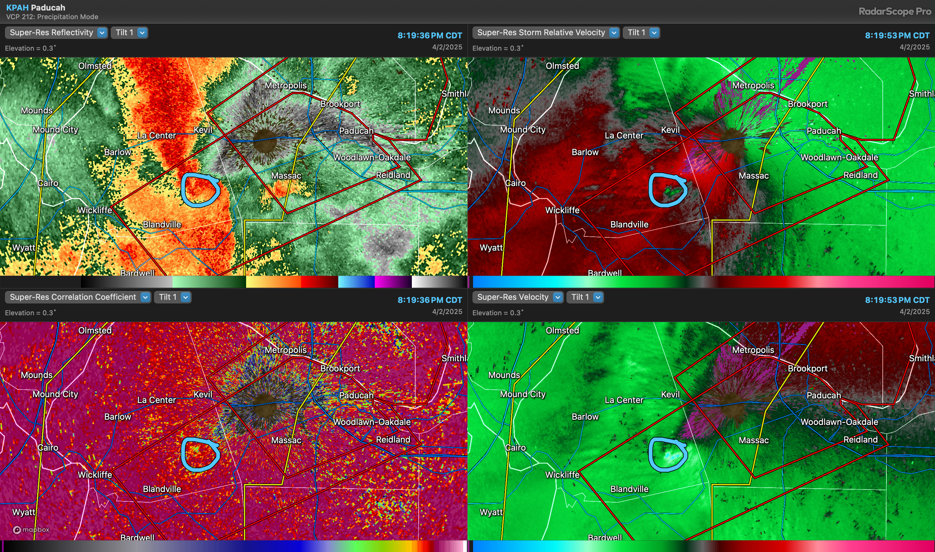
Look out, KPAH…
-
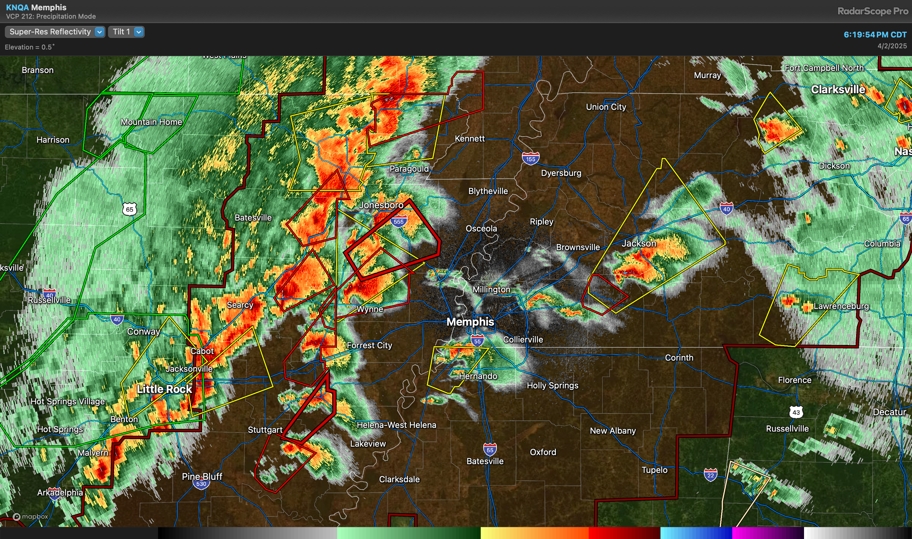
Really impressive line of discrete supercells on the Memphis radar.
-
Much happier with the Mac Studio after making the decision to move forward with a fresh setup. Didn’t realize just how many barnacles I had accumulated with the prior install – everything is just smoother and better.
-
Now that I had a few minutes to import my Mastodon follows, Micro.blog is really taking shape quite nicely as my primary Fediverse presence. Kudos to @manton for how he’s rapidly evolved his product to be a first-class Fediverse citizen.
-
Well, at least nobody sent a Liberian flag in the war plans group chat.
-
I hereby decree that 88x31 buttons on websites are back in style.
-
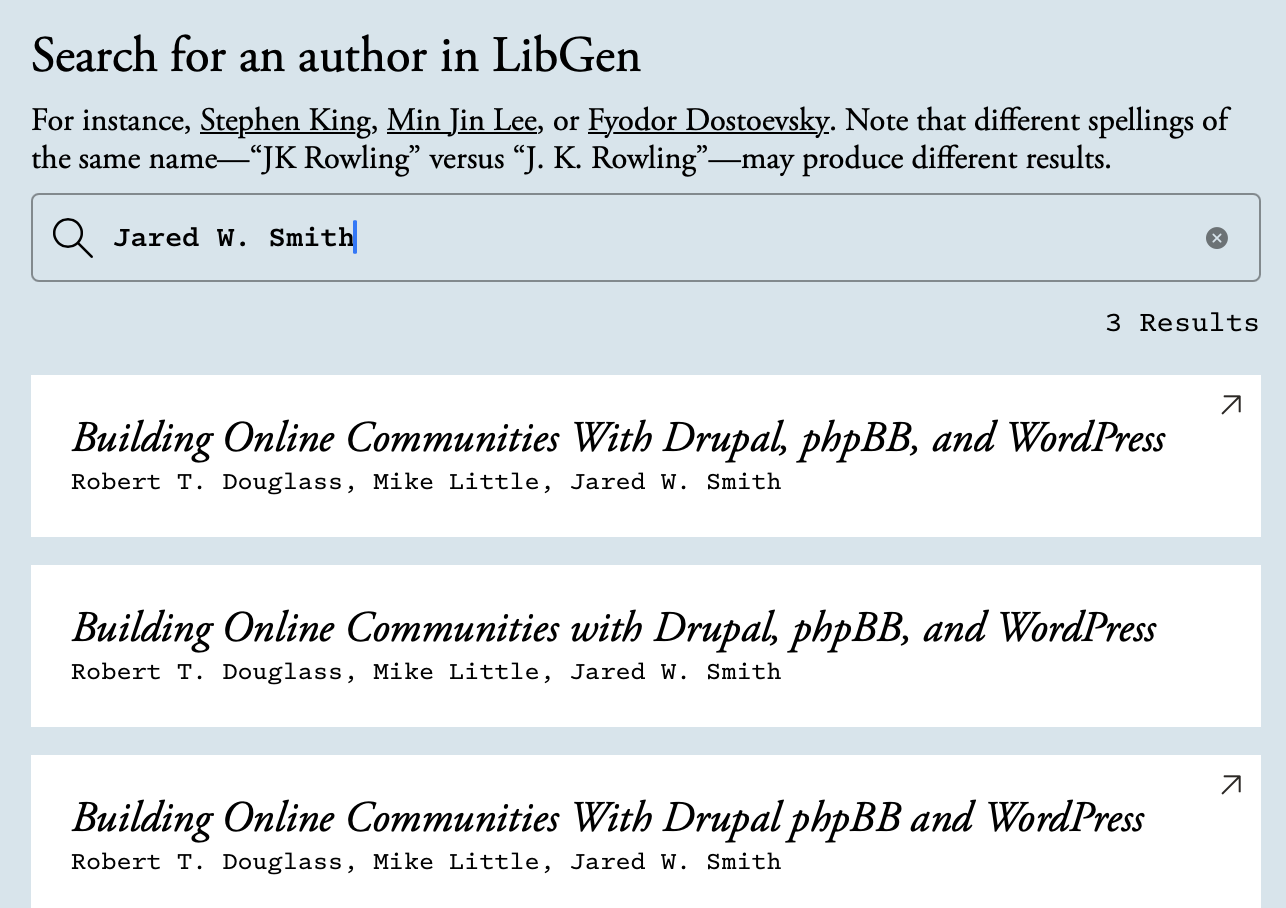
At least the book I co-authored in the mid-2000s lives on in LibGen! 🙃
I don’t really have an issue with this, but what I do have an issue with is Meta training its AI on it, of course.
-
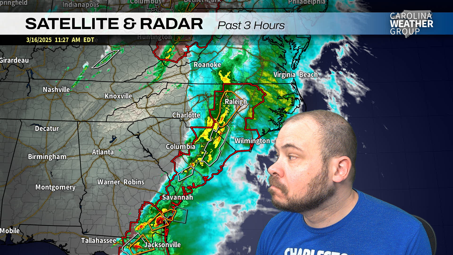
I’ve got my eye on you, storms.
-
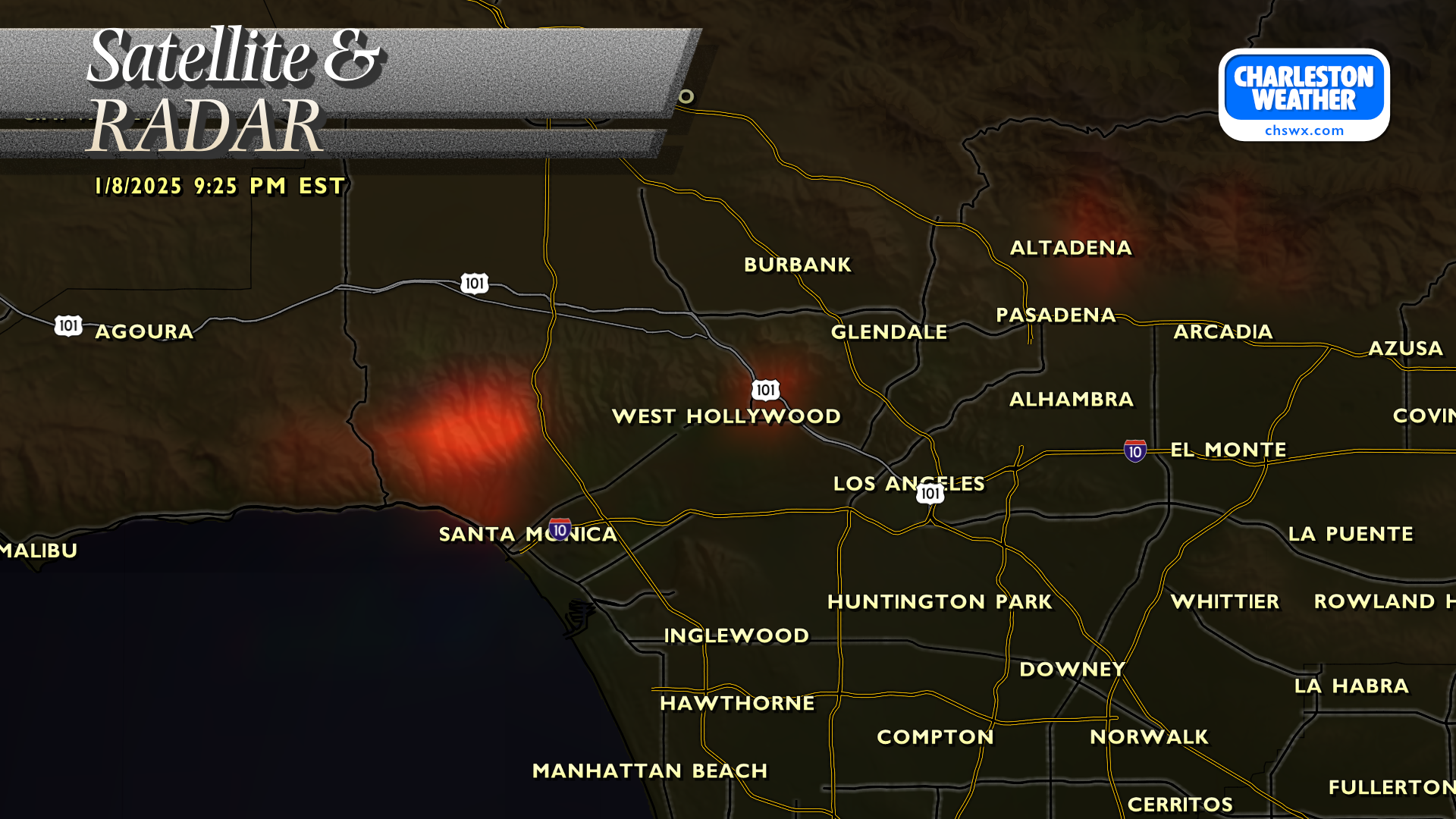
The Hollywood Hills fire is showing up on the Fire Temperature RGB product from GOES-West. Not good.
-
Went out on a limb and joined Team Trackball (Logitech MX Ergo) over on the weather computer, where there’s limited room for mousing anyway. Getting the hang of it, though drawing on the screen will take some getting used to. The precision mode is nice, though, and may help.
-
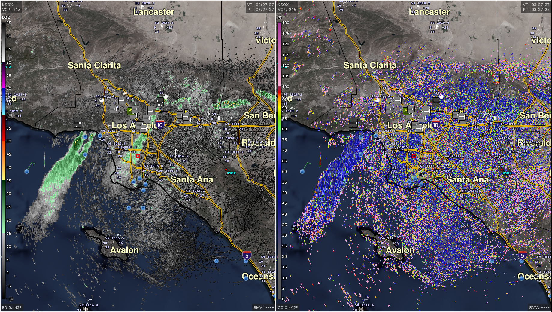
Just a casual 85 MPH wind gust earlier northeast of Los Angeles earlier this evening. Unfortunately, the worst fears around wildfire conditions are verifying here.
-
I’m “oh my god I can’t believe that amazing CSS property is so widely supported” years old.
-
iOS 18.2 seems to have nuked all of my iPhone-to-Mac notification settings. Ugh.
-
In the process of making Micro.blog the center of my slice of the fediverse by migrating my Mastodon account following and followers here. Pretty excited about this – ActivityPub gives us a standards-based opportunity to think differently and break old habits around how we interact online.
-
Folks, it’s The Holiday Season™.
-
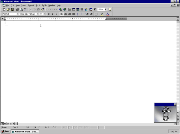
If I ever find myself back in academia, this is how I’m writing my papers. Only way I can truly feel like I’ve achieved the “in-school” mindset.
-
I’ve not been paying much attention to Threads lately, and the growth-hacking notifications have definitely been picking up steam. If there’s one thing Meta knows, it’s how to sound desperate when you ignore one of its platforms.
-
Instead of sleeping at a reasonable hour, I’m considering consolidating my personal fediverse presence on micro.blog to get the benefits of using my domain. Will want to migrate my Mastodon following and the like. Probably worth investigating during my holiday time off. (NERD.)
-
Cracked open the chswxbot parser this weekend for the first time in a while. Starting to add some more metadata parsing for each product. This effort begins with the coastal flood products, hopefully making those automated alerts more useful.
I also need to do some better character-limit wrangling with the influx of folks to Bluesky. You get used to having 500 chars available here. (I’ve already baked in the concept of variable limits, of course, so Mastodon’s support remains first-class!)
-
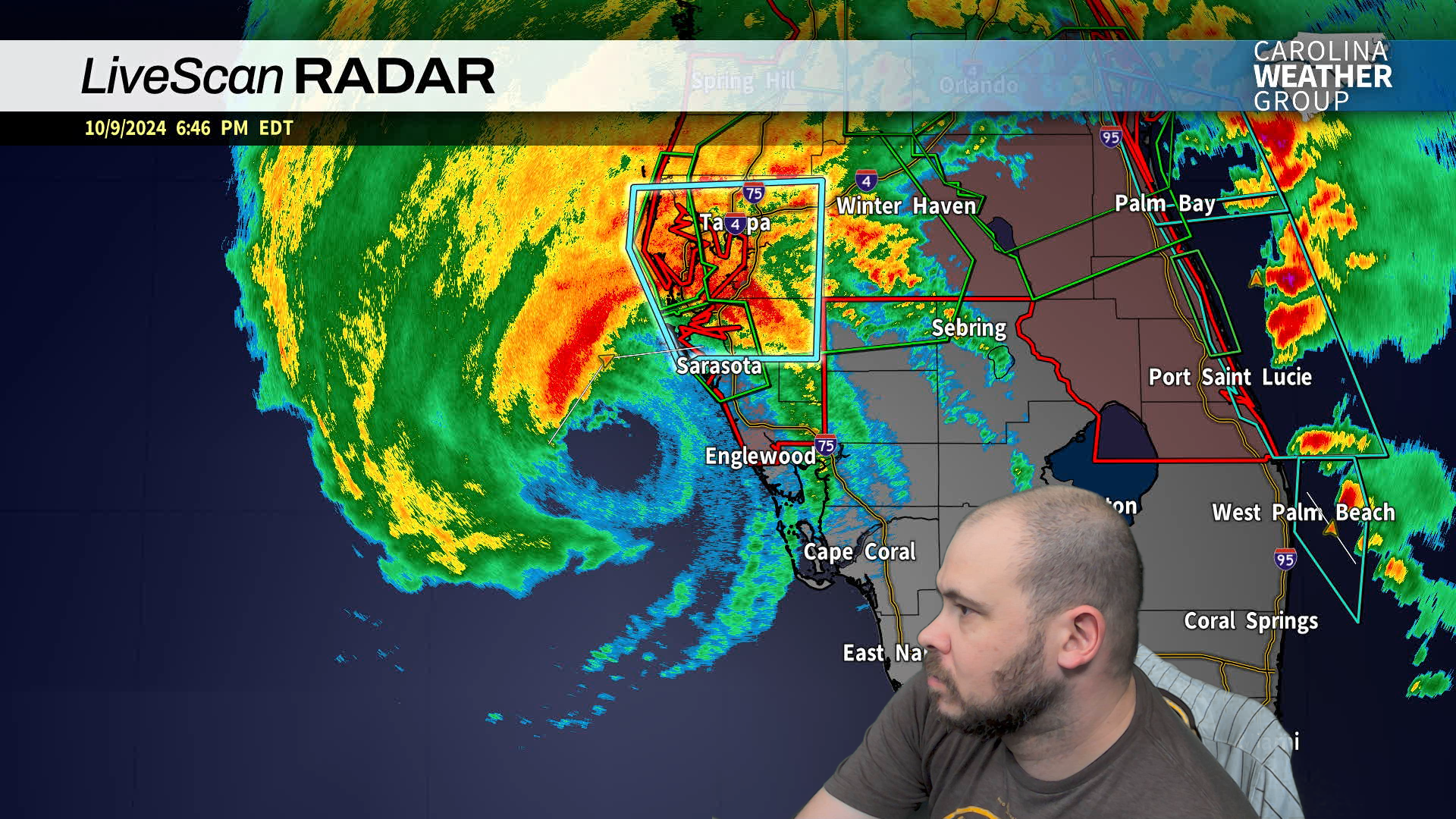
Milton and I don’t exactly see eye to eye.
-
And so concludes probably the most head-scratching tropical storm warning we’ve had here in quite some time.
-
This long day of meetings is brought to you by Purity Ring and coffee.
-
My CoCoRaHS station recorded 61.37” of rain this past year, good for sixth wettest in Charleston County as well as in the NWS CHS CWFA. #chswx #climatology
-
‘23.
-
Never PGEN before coffee. #awips
-
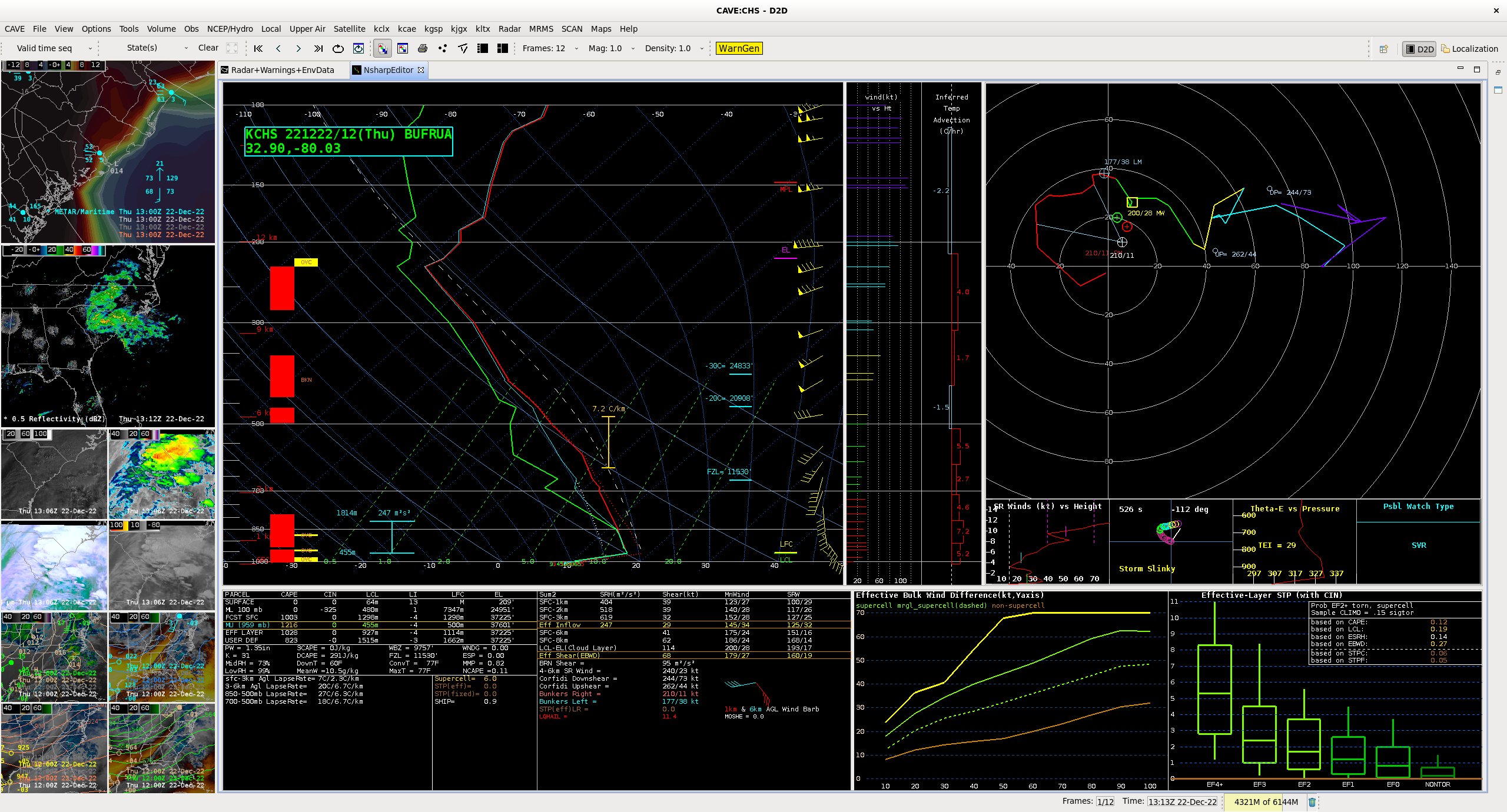
Respectable elevated instability this morning from the 12z sounding from CHS supportive of some supercellular behavior if things really wanted to get feisty. Low pressure moving north of the area will move any severe threat with it, though. #chswx #fediwx
-
Trying external display mode on my iPad Pro (M1). It’s interesting…though probably more of a novelty than anything else. Early days for windowing on the iPad, that’s for sure.
-
It’s above 60°, so the ice cream truck is making the rounds.
-
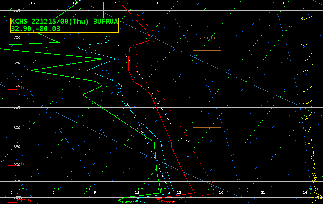
Very shallow wedge inversion on the way to being eroded on the 00z sounding from KCHS this evening. Looks like the warm front is starting to move ashore now; temperatures have risen a degree or two in the last hour.
-
Giving MarsEdit 5 a whirl from the new micropost screen.
-
I rescued my Tumblr account and unearthed this gem. A very young Charlie Brown, think he’s about a year and a half here.

-
So the Elon thing on the bird app seems to be going well. 😬
-
The first production commit to chswx.com in almost two years is a CSS fix for headers running into images. Look, it’s something. More to come.
-
Fediverse offers some interesting possibilities for syndicating @chswx content, such as alerts. I could theoretically set up my own server and then put certain classes of alerts into their own channels along with a catch-all. 🤔
-
Platforms come and go, but standards are (mostly) forever.
-
I’m surprised Apple didn’t delay Stage Manager until spring. My only guess is that they felt they had to get it in peoples’ hands and iterate from there. Vittici was pretty pointed, but constructive, in his criticisms.
-
Tidying things up over here on the ol' micro-dot-blog. Can’t imagine why.
-
Went with the MacBook Pro 14” with the M1 Pro over the M2 Air. For the money I would have spent on the configuration I wanted for the Air, I’d be out several ports and a card reader, not to mention the brilliant ProMotion refresh rate. What a difference from my 2015 13” MBP!
-
The overlapping notification bug was indeed fixed in iOS 15.1, and thank goodness for that. What an annoyance. I’m still surprised it made it to the final release.
-
I hope that someone fixed the notification overlap bug with Summaries in iOS 15.0.2 and just didn’t say anything. That is beyond annoying and makes one of the tentpole features of 15 very difficult to use.
-
There’s a bad bug in the latest Keynote update for iPadOS (and probably iOS, too). If, on first launch, you open a presentation with font warnings, after dismissing the font warning box you’ll be presented with a totally unresponsive Keynote. You have to open a presentation with no font warnings (or start a new one) in order to get Keynote to get going, which I accomplished through the Haptic Touch context menu. Once that’s done, you are prompted with the “what’s new in Keynote” modal…which likely was the culprit for the whole thing. Ugh.
-
This is my favorite thing today. (Yes, I realize it’s early.) I’ve loved Dan Siegel’s music for years, and this interpretation with guitars is so, so good.
-
I think I am finally becoming a real Mac user: both my home and work desktops have gotten uncharacteristically cluttered with lots of random things. (Thank goodness for Stacks.)
-
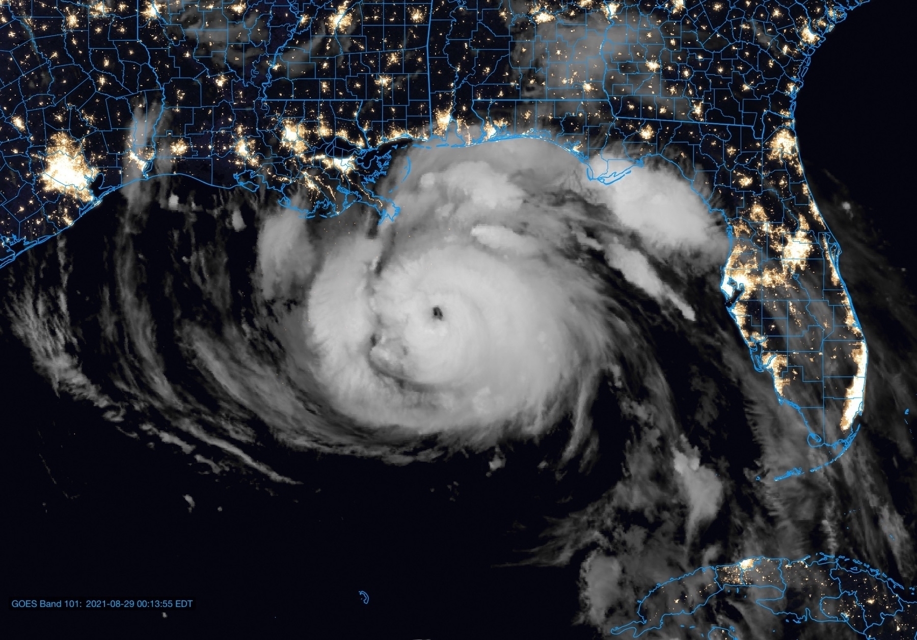
Ida is getting it together at absolutely the wrong time for New Orleans, and it doesn’t look like much will get in its way at this point through landfall. I don’t like it one bit for a whole host of reasons, but especially because it looked once again like there was no plan.
-
Don’t like Ida for my LA/MS/AL Gulf Coast peeps. Please be getting ready now for a major hurricane strike with peak wind impacts in Louisiana — perhaps in the New Orleans metro area — and flooding impacts spreading much further out from the center of the storm.
-
I could do the easy thing, which is to just stick a
localin the path to the PHP interpreter in my LDM ingest script, or I could do the hard thing, which is to Dockerize all of it.Take a wild guess at what I’m doing.
-
Wild Friday night over here doing a deep dive into HTML semantics.
Pro tip: If you list “expert in HTML” on your résumé and I’m interviewing you, I’m gonna test that.
-
Kudos to Apple for reversing course on requiring the bottom-aligned address bar for Safari 15 on iOS. Giving the user choice here was the right call — a win-win for everyone.
-
So far, so good with the fifth betas of iOS and iPadOS 15. Refinements are definitely starting, but there are still plenty of rough edges, which is to be expected at this stage. I’ve come to really enjoy the notification summaries — I added a midday summary to my slate, for a total of three — and find Focus modes extremely helpful. Syncing Focus state across devices solved a problem I didn’t realize I had until I added the iPad to the mix back in June, when my phone would be on Do Not Disturb but I would forget to set the iPad.
I’m running the dev seed of Monterey on my 2015 MBP, and had a bit of a scare last night when I went back to it and it was powered off. I fired it back up, but it promptly went into a reboot loop every time I tried to log in. Shutting the machine down and powering back up took care of it, and the installation finished successfully. I’ve not spent much time with it since then, though. Here’s hoping the public beta goes on a little smoother today on the M1.
Hoping for a watchOS 8 public beta today as well. Battery struggles are very, very real on beta 4 on my Series 4, so here’s hoping those rough edges start to smooth out on beta 5.
-
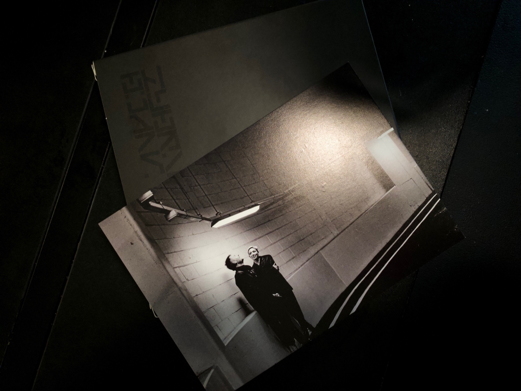
Hybrid Black Halo box set acquired.
I had to buy a SuperDrive to listen to and import these CDs. Completely worth it — Hybrid is quality.
-
Safari’s new design on iOS 15 is a no-go.
I’m usually really good at adjusting to change, but this isn’t taking. I always expect the address to be at the top of the screen. You need good reason to break decades of convention, and this ain’t it.
Hoping for relief in beta 5.
-
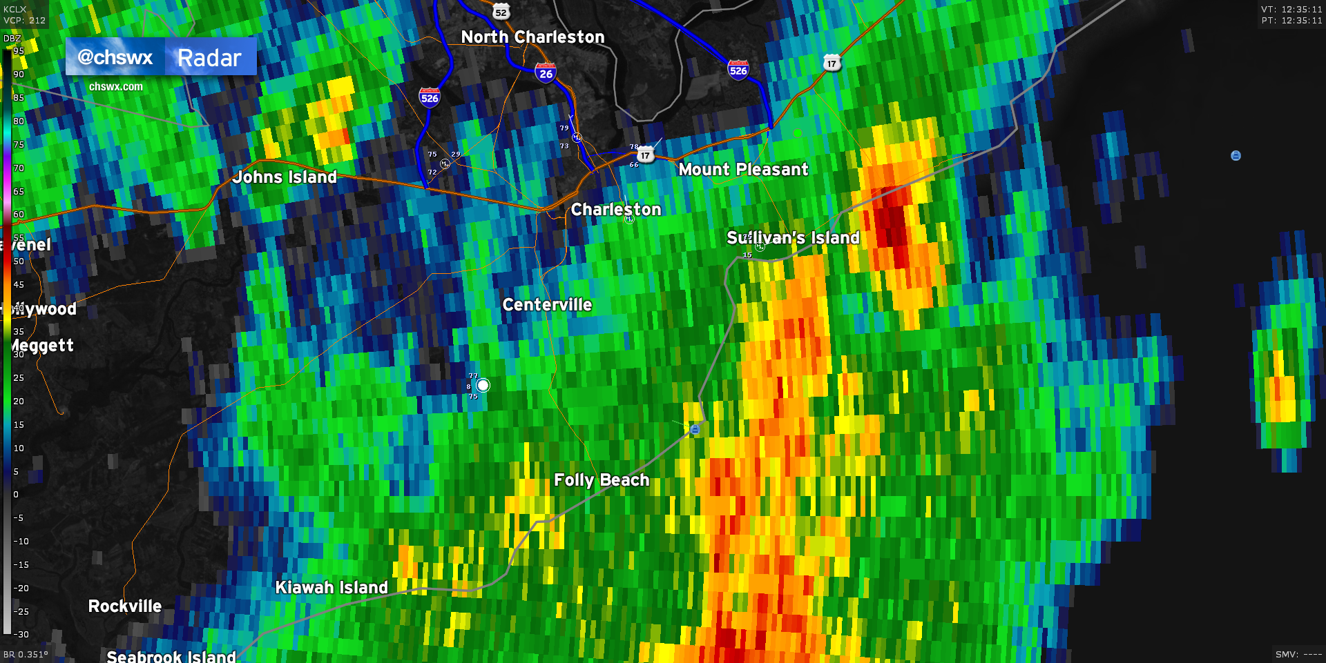
Rejected @chswx tweets/microblogs: “Do you really like long walks on the beach? Prove it.”
-
I think the time is coming to ditch my 4K TN-paneled monitor that I’ve got attached to my Mac mini. I don’t game, I live in text, and I am still unaware of anything better than an IPS panel for textual applications. (I honestly wonder how much eyestrain I’ve incurred because of the TN panel.)
Trying to decide if going ultrawide is worth it at this point, or if I should just stick to a standard wide IPS display with a second monitor rotated into portrait as I have today. If I go ultrawide, I can take the secondary monitor (which has an IPS panel) and move it over to my AWIPS workstation, replacing another older TN panel. On the other hand, I recoil at the price of high-DPI ultrawides, so I might just do the swap.
-
MacRumors reports that iOS 15 will route people around Flash Flood Warnings. At first glance, this appears to be an extremely smart application of the Dark Sky acquisition. It will be interesting to see if this only applies to Flash Flood Warnings or other warning types. It would also be interesting to see if it applies to flood advisories as well. We often see impassable roads here with a Flood Advisory in effect because Flash Flood Warnings in my county warning area are reserved for the most serious flooding events.
-

New shirt! A little more niche this go-around. Here’s a wearable love letter to meteorologists' favorite hunk of Java code anywhere, AWIPS.